ShopDreamUp AI ArtDreamUp
Deviation Actions


Suggested Deviants


Suggested Collections


You Might Like…


Featured in Groups


Description
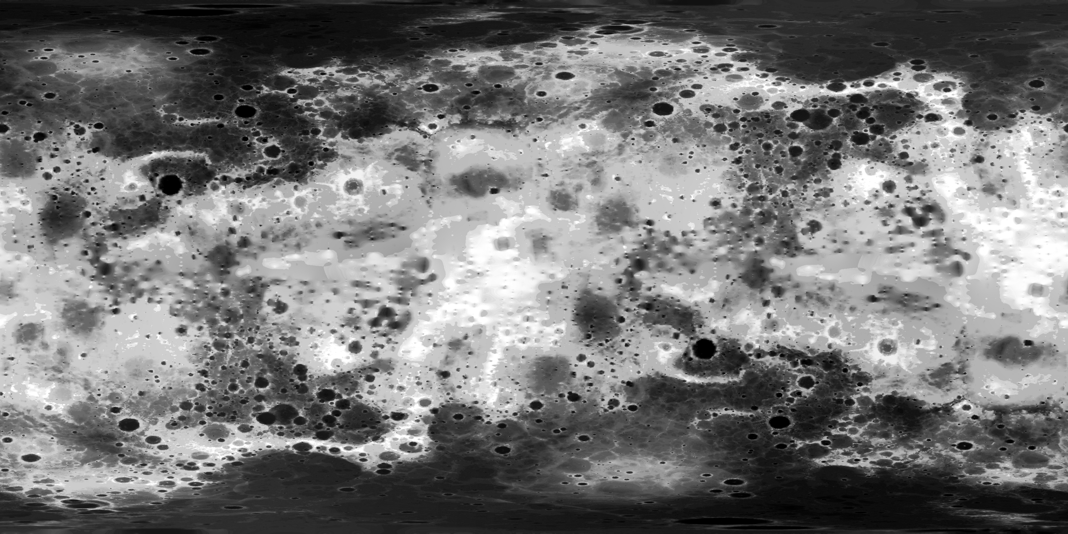
After working MANY hours and countless retries, I think I'm satisfied with this. I took the terrible rainbow data from NASA's Mercury Messenger probe and gray scaled it. I had to take each individual scale of colors (blues, greens, yellows, reds, then the ugly browns) and make a smooth grayscale gradient of them individually then combined them together. As stated previously, I don't have the southern hemisphere data so I took the north and moved it laterally so that it wouldn't be a perfect mirror image. Since I grayscaled the image before I had PS merge the 2 halves, I didn't have to worry about messed up colors screwing up the data.
Since nothing like this exists for anyone online, I've decided to be nice and share it. This is about 6 hours of trial and error work. Take it and use it for your own terraforming projects on celestia and other programs.
I forgot: The image is reversed. The little 'island' in the bottom middle should be at the top middle. This is the source page messenger.jhuapl.edu/the_missi…
Image size
3500x1750px 4.31 MB
© 2013 - 2024 1Wyrmshadow1
Comments5
Join the community to add your comment. Already a deviant? Log In
Comment hidden